Crater of Diamonds State Park: A wonderful and crazy place

July 28, 2011

When I accepted the park interpreter job at the Crater of Diamonds State Park, I had no idea what a wonderful, fascinating, amazing, and sometimes crazy place this park would turn out to be.  So, I want to share with you some of the wonderful and crazy things that make this park so unique.

Visitors heading out from the Diamond Discovery Center to "the field."

Visitors heading out from the Diamond Discovery Center to "the field."

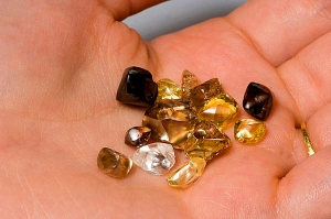
Of course, the first thing that makes this park so unique is that our visitors are allowed to hunt for diamonds, and then are allowed to keep them.  Yes, real, sometimes valuable, diamonds.  But, the crazy part is that they not only get to keep any of the diamonds that they find, they also are allowed to take home any of the over 40 other rocks and minerals that are found here.  In fact, each visitor is allowed to take home the equivalent of a 5-gallon bucket of those rocks and minerals.

The Crater is a small park, only a little over 800 acres, in a rural area of southwest Arkansas, 40 miles from the interstate and 60 miles from the nearest city.  The crazy part is that last year over 119,000 people found their way to this park.  Even more amazing is the distance that people will come to this visit this park.  Last spring I gave a demonstration to three men—one from Washington State, one from Florida, and one from Texas.  As I am chatting with visitors I often ask them if their stop at the Crater is part of a more extensive road trip.  I find it astonishing the number of times they answer “Oh no, we intended to come here and this was the only destination on our trip.”  So, this obscure little park is actually a destination, in the same way that Yellowstone and Grand Canyon National Parks are destinations.  Every year we have visitors from almost every state in the Union, including Alaska and Hawaii.  We even have a significant number of visitors from foreign countries.  It is a wonderful place to work because our visitors are so diverse.

Just some of what can be found and kept at Crater of Diamonds State Park.

Just some of what can be found and kept at Crater of Diamonds State Park.

All of the dreams that people have when they come to this park is another wonderful thing.  For many of our visitors their Crater visit is the fulfillment of a dream that sometimes has continued for as long as twenty years.  The crazy part is that it is impossible to guess which person in the group was the one with the dream.  Sometimes it is a young child, as young as 10 years old, who somehow learned about the Crater and has been badgering his or her parents to bring him here ever since.  Sometimes it is an elderly person, like one visitor, who was in hospice and decided that one of the last things she wanted to do was to gather her family, come to the Crater, and watch them hunt for diamonds as she sat at the edge of the field in a wheelchair.  Grandparents who visited the park as a child bring their grandchildren.  Often the trip is a family outing, bringing everyone from the newborn to the great-grand parent, and all of the parents and cousins in between.

I enjoy eavesdropping on our visitors as they dream aloud to the other members of their party about what they would do if they found “The Big One.”  Everyone, young or old, always has something that they would do or buy if they found that large diamond.  But it is also crazy that coming to this small state park can be, and sometimes has been, a life-changing event for our visitors.  Everyone celebrates when they find a diamond, whether it is the tiniest gem that is just industrial grade, or it is a large, flawless diamond, possibly worth tens of thousands of dollars.  For those of us who work at the park and get to be part of these almost daily celebrations, each diamond registration is a fun experience.

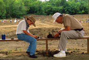
Everyone enjoys a day in the dirt!

Everyone enjoys a day in the dirt!

Most people have a pretty good idea about what they are going to do when they plan their visit to a state park.  They already know how to fish or play golf, and have been hiking and camping for many years.  At the Crater it is a rare individual who arrives already knowing how to hunt for diamonds.  Many expect it to be a mine and they will have to go underground.  Most have never seen a rough diamond, and so have no idea what they are looking for.  As a staff member it is a constant challenge to help our visitors figure out the information they need to find a diamond.  We provide videos, demonstrations, and exhibits on finding diamonds, so that our visitors will have the best possible chance.  However, I find it fascinating to see the inventive things that people bring to the Crater as potential diamond finding equipment.  The range is very broad, from a dryer lint screen to elaborate homemade and hand-powered shakers and sifters.

But, the most crazy and wonderful part of the Crater experience is what a good time people have when they visit.  It can be 20 degrees in January with a quarter of an inch of ice on the wash troughs, or it can be 100 degrees in the shade in July.  It can be a sea of mud from one end of the field to the other.  If you ask a visitor if they had a good time, when they bring up their precious rocks that they have carefully chosen, hoping that one is a diamond, they almost all will report that they had fun.  Many of them are already planning what they will do when they come back the next time.  With that kind of response, it is a privilege to work at this small unique park with its large visitor experience.

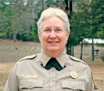
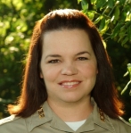
Margi Jenks, Park Interpreter

Margi Jenks, Park Interpreter

Margi Jenks is a recent convert to working as a park interpreter.  For twenty years she worked as a geologist, making new geologic maps of parts of Oregon, Idaho, and Washington State. Her research interests were volcanoes and their interactions with ancient large lakes.  So, working at the Crater of Diamonds State Park is a natural fit, with its 106 million-year-old volcanic crater containing those beautiful and fascinating diamonds.


The Once and Future Mather Lodge

June 9, 2011
Restaurant after demo 3/12/11

Restaurant after demo 3/12/11

Restaurant during demo 2/17/11

Restaurant during demo 2/17/11

Restaurant pre-demo 12/8/10

Restaurant pre-demo 12/8/10

On December 1, 2010, Petit Jean State Park’s historic Mather Lodge closed its doors – but not forever.  The lodge closed for more than a year’s restoration, renovation and major rebuilding.  On the first of December, for the first time in nearly a half-century, the day had come again to begin construction on a modern new restaurant to adjoin the old lodge – a restaurant designed by architects to capture the park spirit and “parkitecture” of the original Mather Lodge’s rough-hewn, large stone and log structure.  The upcoming restaurant will offer a spacious and modern facility that is larger, more capable of seating guests and groups and will include a 75-person conference/dining room.  The next Mather Lodge Restaurant, due to be completed in spring 2012, as well as restoration of the original, historic Mather Lodge, mark yet another significant stepping stone into the interesting future of Arkansas State Parks.

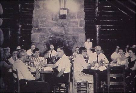
Mather Lodge was originally completed in 1935, one of several Civilian Conservation Corps (CCC) projects put in place during the first building phase of Petit Jean State Park.  In keeping with a nationwide park trend of offering rustic yet gracious amenities to the visiting public, a restaurant was built on the northern side of the lodge just off the main fireplace lobby.  A small kitchen, complete with wood stove for heat, adjoined the restaurant just north of the dining room’s large stone chimney. Hired cooks prepared meals for visiting groups, or sometimes the visitors came in, by reservation, and cooked up their own meals.  The old restaurant dining room is called the CCC Room today and will continue to be visited for its historic significance.

Dining Guests at Original Restaurant 1950s (Not being removed, now called the CCC room)

Dining Guests at Original Restaurant 1950s (Not being removed, now called the CCC room)

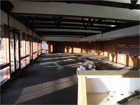
By the mid 1950s, the baby boom was underway, and parks were experiencing a swell in attendance but with deteriorating resources.  On the federal level a project called Mission 66, lasting from 1955 through 1966, drew funding for major recreational improvements nationwide, while Arkansas State Parks initiated improvements of their own.  In 1958, a swimming pool was constructed in the courtyard just behind Mather Lodge.  Six years after, in 1964, a second, larger Mather Lodge Restaurant was constructed adjoining the original lodge.  This was the restaurant that served the public until December 1, 2010.  The Mather Lodge Restaurant built during the baby boom era was extremely spacious by 1960s standards and featured plank beams in a vaulted ceiling above the dining area and an incredible view through large windows of the park’s lower canyon looking west toward the Arkansas River Valley.  Many today remember dining or conferencing there.

By the turn of the century, Arkansas State Park visitation was higher than ever.  Petit Jean State Park alone had approximately a half million visitors every year.  On a busy day during the first decade of the 2000s, parking space near the lodge was limited, the Mather Lodge Restaurant was often packed with people, and lines formed getting into the few restroom facilities available.  It was time, yet again, to meet public demand with more up-to-date park facilities.

The last photo of the 1964 Restaurant (tables & chairs removed).

The last photo of the 1964 Restaurant (tables & chairs removed).

As of this writing, the construction of the new Mather Lodge Restaurant, designed by Little Rock firm SCM Architects is well underway.  The foundation has been laid, and the SAMCO Construction Company, based in Cabot, Arkansas, is at work sealing the base and readying the outer building.  The SCM Architectural firm describes the project as follows:

“An interior and exterior renovation is underway at historic Mather Lodge which will expand the hospitality offerings of Petit Jean State Park. A new inviting lobby and restaurant waiting area will provide improved access and increase the lodge’s capacity to welcome guests and operate efficiently. The existing restaurant and kitchen, built in 1964, will be demolished and replaced by the new lobby, new restaurant and new kitchen. The lobby and restaurant will feature exposed log construction, use of natural materials, and extensive glass window walls to provide a full view of the natural beauty surrounding Mather Lodge. The addition will also include lodge and restaurant offices, a private dining room, and public restrooms, as well as a new pool and new outdoor spaces.”

Looking at the new addition from the west. The current lobby (historic) is to the right of the restaurant, the rest of the lodge is out of frame.

Looking at the new addition from the west. The current lobby (historic) is to the right of the restaurant, the rest of the lodge is out of frame.

Arkansas’s first state park proudly welcomes this next step into the future.  Since the park’s beginning in 1923, Petit Jean has been a place for lifelong memories to be made.  Petit Jean State Park offers calming, scenic views, hikes along a diverse series of beautiful park trails, comfortable, rustic cabins and lodge rooms, great camping spots and – in the near future – a fine, new, hospitable lodge restaurant to enjoy at leisure.  We welcome everyone to join us at Mather Lodge in the coming years for some of the best moments of your lives.

(note: Although the lodge & restaurant are unavailable during new construction, the cabins are available. Contact the park for more information.)

BT Jones, Park Interpreter

BT Jones, Park Interpreter

BT Jones is a park interpreter at Petit Jean State Park and has worked there since 2005.  He holds a master’s degree from the University of Arkansas at Little Rock.  BT is a member of the National Association for Interpretation (NAI) and holds a Certified Interpretive Guide credential.  He is also a Leave No Trace (LNT) master educator and works as an advocate for Arkansas wilderness as a wilderness ranger.  BT’s pasttimes are nature and wildlife photography, hiking and backpacking, and helping to preserve Arkansas’s wilderness and natural areas.  He most enjoys hiking with park visitors and presenting programs on Petit Jean’s natural and historical features.


What? No Dinosaurs?

September 22, 2010

As an interpreter at an archeological park, I have my work cut out for me.  I do not have the geology or the beauty of Lake Ouachita, nor do I have Mt. Magazine’s View to draw visitors to my door.  What I do have, is a fabulous resource- an incomparable resource- that never ceases to amaze and astound me.  But, admittedly, it is a resource that only a fraction of a percent of people know and care about.

Parkin Archeological State Park is the location where, in 1541, Hernando de Soto held the first Catholic mass west of the Mississippi.  We are the home of Casqui- the toughest, most feared chief of his time and the chief that de Soto himself mentions about above all others encountered on his 4 year hike though the American southeast.  Pretty cool, huh?  Yeah, maybe if you’re an archeologist or a park interpreter with a few anthropology courses under her belt.

Who doesn't like some good pottery?

Who doesn't like some good pottery?

Then there’s everybody else. I have to work pretty hard to make people interested in this resource.  They are people who are, if truth be told, truly on their way somewhere else but thought this might be a great place to stop and stretch their legs.  I cannot tell you how many people see the “Archeological park” sign on I-40 and exit because they think we’ve got dinosaurs.  When a 9 year old boy thinks he is coming inside to see t-rex only to find that what I have is pottery… that is supreme disappointment.  But what an interpretive opportunity!

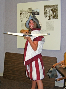
Be a Conquistador for a day!

Be a Conquistador for a day!

Here at Parkin, we have an entire collection of Spanish conquistador clothing, armor and weapons. When kids dress like a conquistador, they forget they wanted to see dinosaurs at all.  They put on that helmet and pow! Instantly, they assume the Conquistador pose (you know the one- with one boot clad foot on the mound, hands on hips, hair blowing in the breeze underneath their helmet- don’t act like you’ve never struck this pose before) and from there, they are hooked on Parkin.  Add the conquistador gear to the collection of replica Native American spears, arrows, and atl atls, and we are the coolest thing kids of any age have seen in a while.

Somebody likes history...

Somebody likes history...

We do have other types of visitors besides the interstate exit crowd- visitors who actually know we are about Indian mounds, but are under the impression that they can dig here.  That is another interpretive opportunity completely.  You see, what we have is a finite resource- they just aren’t making Indian mounds anymore.  We cannot let you dig in our mound and expect to have anything left for people to see next week.  What we try and do, diplomatically, firmly, yet with a smile on our face, is tell them about the Federal laws which prohibit such activities and then hand them a Park Informational Brochure about the digging opportunities at Crater of Diamonds State Park.

Then there are the immutable types of visitors.  The rockhounds.  The Aztec enthusiasts.  The people who want to establish a connection between our site, the pyramids of Egypt, and possibly even aliens.  These guys are hard sells.  I had a man last week who was disappointed that we did not have more arrowheads on display.  I tried to explain to him that our pottery in the museum is world renowned, and that is what we choose to focus on.  He just would not let it go.  “Well, Cahokia has points everywhere,” he said.  I tried explaining for 20 minutes that I had visited Cahokia and that I was surprised by their lack of pottery on display (with the exception of pieces that were credited as coming from Arkansas) but this did not seem to phase him.  Education did not work with this guy.  He was disinterested in de Soto.  He could care less about headpots.  He told me he wanted to come back, and fully expected us to “make our museum just like everybody else’s.” Well, in the end all I could wonder was if the Interpreters at the Grand Canyon have problems with people wanting a beach.  Probably not.

A little "hands on" history!

A little "hands on" history!

I do welcome the challenge of educating people like him, and the beauty of the job is that very next person to walk in the door could be a visitor like me.  The “one half of one percent” visitors who love de Soto, are familiar with his trek through Arkansas, and who are yearning for me to tell them more.  I love to share the stories de Soto left with us- how Parkin’s Chief Casqui was the most feared chief in Arkansas, and how rich the culture was here in Arkansas.  I love to show our artifacts and leave people pleasantly surprised about our Arkansas history and heritage.

In short, we get all kinds of visitors here.  I like the people who dress like de Soto.  I look for the chance to educate potential collectors about NAGPRA legislation (Native American Graves Protection and Repatriation Act) and why it’s important.  I even relish the opportunity to hear an interesting new twist on the Stargate series and how it applies to Parkin.  But as for the man who wants us to make out museum just like everybody else’s… there’s an old adage that gets me through those experiences with sanity and a smile.  “Never try and teach a pig to sing- it wastes your time and just annoys the pig.”

(Note to reader: Ms. Parker in no way is relating visitors to pigs, though she thinks pigs are wonderful and admirable animals.  The adage was meant to be a funny tagline to an exhaustive experience she recently had with a visitor.)

Mary Anne Parker, Park Interpreter

Mary Anne Parker, Park Interpreter

~Mary Anne Parker has been with Arkansas State Parks since 2005, and as Interpreter at Parkin Archeological State Park since 2006.  Mary Anne’s primary focus at Parkin has been on the African American Experience in the Delta, and she is extremely proud of the growth in community support the park has experienced with the renovation and opening of the Northern Ohio School in 2006. Her other interests and activities include running the Parker Homestead, which she owns and operated with her husband and his parents, and writing grants to further educational opportunities for students attending Arkansas Delta public schools.


Petit Jean State Park’s Archeological Treasures

July 1, 2010
Bison Drawing

Bison Drawing

Most visitors to Petit Jean State Park in the Arkansas River Valley remember it as a place of majestic scenery, beautiful trails, and hospitable, friendly people at the park’s visitor center or historic Mather Lodge.  But those interested in the distant past will also remember fascinating geology, as well as rare rock art found in the park’s primary archeological site: the Rock House Cave.  Petit Jean State Park holds a treasure trove of archeological significance.

By 900 AD, Native Americans across the southeast began to settle along main waterways, including the great Mississippi River as well the Arkansas River to the west.  This time

Footprint Drawing

Footprint Drawing

period is known as the Mississippian Era.  A new way of life developed based on the agricultural production of beans and squash, as well as corn imported from long-distance trade with people from the south.  Fortified towns arose, and platform mounds were used for ceremonial purposes.  Societies developed that were highly organized, and there were powerful leaders among provinces.

One such province was called Cayas, and it was located near Petit Jean Mountain.  The Arkansas River, which flows just north of Petit Jean Mountain, was then called the River of Cayas.  The people of the scattered settlement of Tanico, in the province of Cayas just

Head Dress Drawing

Head Dress Drawing

west of Petit Jean Mountain, made beautiful pottery, gathered crops, made excursions to find wild game, and to gather salt – a highly-valued element necessary to the survival of the people.  Salt was also traded for other goods when enough could be gleaned by boiling it from brackish ponds.  It is highly probable that rock art found today in Petit Jean State Park was created by the culture that inhabited Tanico.

During tours to the Rock House Cave, visitors often ask if Indians once lived on the mountain.  The answer is yes, especially in earlier eras dating back to the Paleoindiantime, around 10,000 years ago.  By the time of Mississippian culture, though,

Mississipian Symbol Drawing

Mississipian Symbol Drawing

what we know today as Rock House Cave, above Cedar Creek’s lower canyon, was only inhabited during special rites of passage or sacred ceremonies.  In fact, the Petit Jean Mountain plateau was possibly considered a sacred area – a great temple mound above the River of Cayas.

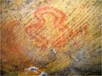
The meaning of the rock art that remains today is still mysterious in many regards.  Some figures clearly represent animals – zoomorphic.  Others are in the likeness of people – anthropomorphic.  Painted images are called pictographs.  Etched or carved images are called petroglyphs.  Long-lasting paint was probably made by adding ground-up mineral pigments of hematite, magnetite, or possibly charcoal to a sticky substance such as

Paddlefish in Trap Drawing

Paddlefish in Trap Drawing

blood, animal fat or even egg white.

In the Rock House Cave today, interested people may find the likeness of a paddlefish, next to a fish trap made of woven wood, or an often-used symbol which also appeared on Tanico pottery but whose meaning has been lost, or the likeness of a woodland bison, or a symbol of an important person in headdress, or a strange snake-like, or river-like, curved image next to a footprint.  The visitor’s guess may be as good as the local archeologist’s.

Those who come to Petit Jean State Park are invited to see this authentic Native American rock art first hand.  But please treat it with care.  Graffiti and wear-and-tear from heavy park visitation takes its toll.  The Rock House Cave is one of the few places where anyone, with no special permission required, may discover such precious windows to the past on any day of the week, from 8:00 AM until dusk.  Come and see them for yourself.

BT Jones, Park Interpreter

BT Jones, Park Interpreter

BT Jones is a park interpreter at Petit Jean State Park and has worked there since 2005.  He holds a master’s degree from the University of Arkansas at Little Rock.  BT is a member of the National Association for Interpretation (NAI) and holds a Certified Interpretive Guide credential.  He is also a Leave No Trace (LNT) master educator and works as an advocate for Arkansas wilderness as a wilderness ranger.  BT’s pasttimes are nature and wildlife photography, hiking and backpacking, and helping to preserve Arkansas’s wilderness and natural areas.  He most enjoys hiking with park visitors and presenting programs on Petit Jean’s natural and historical features.


Artifact Tales

March 25, 2010
More than a collection of rocks. How did they get here?

More than a collection of rocks. How did they get here?

Artifacts amaze me. It is a simple statement but every word is true. In certain cases, they are the only link that we have to past cultures. This is true at Toltec Mounds Archeological State Park. The American Indians that lived here are called the Plum Bayou Culture and they left clues to their way of life in the form of artifacts. They lived at this site around 1,200 years ago and were resourceful, innovative human beings that were not that much different from you and I. They probably got up in the morning with a mental “to do” list that may have included going hunting, making pottery or repairing a thatched hut. There is so much that we are still trying to learn about their way of life. We are learning more and more every day thanks to the artifacts and features that were left.

At first glance, stone artifacts are simply pieces of rock that have been shaped into something useful. But upon closer examination, stone artifacts tell a story. I grew up in the natural division of Arkansas known as the Delta. I played in the farm fields, explored wooded areas around my house and helped my parents plant a garden during my childhood. I never thought about it then but looking back, not one time did I ever find a rock in the ground. Toltec Mounds is in the delta and there are no rocks here, yet we find artifacts made of stone. That stone is not native to this natural division. Where did it come from? Some of it can be traced back to the Ouachita and Ozark Mountains as well as the Arkansas River Valley. Whatever the origin, it had to be brought in from a great distance.

Each artifact tells a story.

Each artifact tells a story.

Today, moving supplies over long distances is as simple as getting in the car, driving for a few hours, loading your supplies in the trunk and driving home. Now let yourself go back in time for a moment. Travel wasn’t as easy then as it is now. There were really only two modes of transportation at that time; walking or dugout canoes. If walking was the chosen way to travel, then following a foot path through the woods would have taken you to your destination. Fast, no. Imagine the return journey. Packing heavy loads of chert, novaculite or quartz would have certainly added to the burden. Dugout canoes might have lightened the load but only after you took the time to learn the art of making one strong enough to carry you and your treasure. Cutting/burning down a tree and using coals from a fire along with stone tools to hollow it out was no easy task. What a difference time has made.

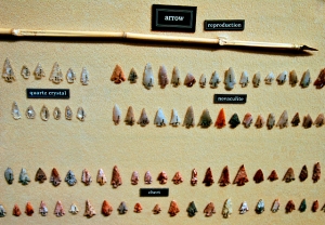
When stone artifacts are found here at Toltec, they tell a tale. The material that the artifact is made out of tells where and how far people traveled to get the raw material. The shape and style of the projectile points can help to determine its age. What it was used for helps to reveal a little about the cultures lifestyle. The more artifacts that we find, the clearer the picture becomes.

Could this have once been a major commerce area?

Could this have once been a major commerce area?

Artifacts amaze me. They are the only voice of the Plum Bayou Culture. Something made so long ago can still speak to us if we know how to listen. Archeologists are still uncovering the stories of the past at Toltec. With every artifact that we find, we learn more about this long vanished culture. Toltec Mounds Archeological State Park is hosting the annual training dig June 5th through the 20th of 2010. This dig is coordinated by the Arkansas Archeological Society and they invite you to participate. If you would like more information about how to be involved in this dig, contact the park.

Robin Gabe, Park Interpreter

Robin Gabe, Park Interpreter

Robin Gabe has been a park interpreter at Toltec Mounds Archeological State Park for eight years. She began her career with Arkansas State Park system as a seasonal interpreter at Lake Poinsett State Park. She grew up in Caldwell, Arkansas and received her Bachelor’s of Science in Education from Arkansas State University in Jonesboro in 1997.


Petit Jean State Park: A Place Where You Can Go Home Again

February 18, 2010

“Experiencing the changes in life over the years has meant more to me than simple aging.  It has meant watching the landscape and the world become more tame, drab, and developed.  Human life and wildlife are both losing their world.”   – Barbara Kerr

I have spent more than a few hours in January reviewing Ken Burns’ recent documentary The National Parks: America’s Best Idea and have learned a great deal from it, both factually and emotionally.  The documentary has helped me to piece together some scattered thoughts.

A map was drawn up by the National Park Service of Petit Jean.

A map was drawn up by the National Park Service of Petit Jean.

I found it interesting, even before I ever served as a park interpreter at Petit Jean, that this state park has ties, and some similarities, to national parks: We have a lodge named for the first Park Service Director, Stephen Mather, who visited here in the 1920s to help strengthen a new Conference of State Parks. Our country doctor/park founder, T.W. Hardison, originally had the national park idea in mind when he first met with Mather.  They would meet again, and Hardison would come to know Mather as a friend and fellow conservationist.  Petit Jean State Park has a set of archived park plans (on display at the visitor center) drawn up by the National Park Service during the time of the Civilian Conservation Corps – another tie.  The idea of setting this beautiful, rugged area aside to be conserved for future generations parallels the notion that began the national parks.  It follows the same pattern.  As our Executive Director of Arkansas Parks and Tourism, Richard Davies, noted in a talk back in December, “Our state parks are the ‘child’ of national parks.”  It’s a pretty accurate metaphor.

Though I believed I knew the answer, I have asked myself on several occasions recently, “Why do I like parks so much?”  And the more I think about it, the deeper the answers run.  There are volumes.

One reason might be summed up by the title of a Thomas Wolfe novel, You Can’t Go Home Again.  Wolfe’s title refers to change.  In time, change may alter any place – even home, or maybe especially home – to a point that it is no longer the same place.  It’s not home as you knew it anymore.  You can’t go there anymore.  The sentence/title strikes a chord with me because it is so true.  But parks are, by nature, change-resistant.  The idea is to let them remain “home” to the people who visit them generation after generation.  A person who made the hike to Cedar Falls fifty years ago can return today, make the hike, and little has changed.  Somewhere, deep down, that must be a source of inspiration and perhaps a source of great relief as well.
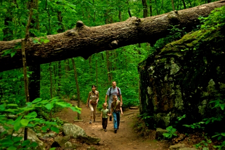
Hiking the trails at Petit Jean State Park is timeless.

Hiking the trails at Petit Jean State Park is timeless.

When I was eight years old, a clever second-grader, I made one of my first organized hikes – a very special one.  It was not in a park, but it was in a place very much like a park – a natural area with an expansive reach and an interesting history.  Four generations of my family had just come back from a service at a small country church.  My grandmother provided music at the church’s piano.  There were my younger sister and myself, our parents, my father’s parents, and my father’s mother’s parents.  From my great-grandparents’ old country house, we all made an afternoon walk up our home stream, the North Fork of Ozan Creek.  This old creek sliced through the Gulf Coastal Plain of southwest Arkansas, revealing colorful rounded stones washed away from conglomerate outcrops and mounds of slate-blue clay the local people called “Indian soap.”  The creek’s water was clear and churned down riffles into long pools that again became lively riffles.  Caddo burial mounds dotted the countryside along the creek, and artifacts from that culture turned up everywhere.

We hiked for several miles that afternoon, on a pretty well-established trail, and for the first time I got to see places that would become an embedded part of my early life.  There was one spring, in particular, that flowed down a clay embankment, leaving multi-hued mineral patterns on a cusp that faced a small pool which emptied into the creek.  My buddies and I would later dub it “Buffalo Spring” because of its brown colors.  The trail builders, whoever they may have been, created bench paths that cut midway along the sides of the bluffs some thirty feet up over the creek.  Hardwood and pine canopied the creek corridor, and down along the creek bed were springs and more springs, feeder streams, canebrakes, and openings into fields.  Our final destination that day was a waterfall, about five feet high and twenty feet across, with a darn good swimming hole washed out beneath it.  And I found my eight-year-old self in love with a place.

Late that afternoon, I settled in warm by the fireplace at my great-grandparents’ house, thinking about it all.  I hoped that we would all do the hike again next week.  But it didn’t happen.  Then I wished that we would do the hike together again later on.  But time passed, and changes came.  My great-grandparents and grandparents grew older, my parents grew busier, and that group of eight would never make the hike to the waterfall again.  For the four generations, it turned out to be a one-time experience.  Later in my childhood, though, I became as intimately familiar with the Ozan and its surroundings as I was with each of those members of my own family.  Three other boy companions lived just down the road.  We kept the Ozan Creek company for years and, looking back, were pretty good caretakers.

We witnessed the dynamics of the stream, knew the scents and sounds and responses to seasons.  Spring rains brought the big, swift, brown water out of the banks.  When the creek settled down, expansive new rock bars appeared, newly washed out swimming holes were discovered, while other pools were filled in with stone and gravel.  One swimming hole, the flood-scoured floor newly-cleared to reveal a large deposit of blue clay, became known to local people as the “Blue Hole” or “Clay Bottom.”  I was baptized in that swimming hole one summer Sunday afternoon.  Afterwards, my buddies threw me off the diving bank and “re-baptized” me.  Summer droughts brought shallow pools laced with algae; riffles turned to dry rock.  Long-ear sunfish made nests in shallows and dutifully defended them.  Small chain pickerel darted beneath grassy banks.  There were cottonmouths all along the creek, a species that I would later learn defines a healthy watershed – but if you want to stay healthy, don’t let them get their fangs into you.

As we grew older, our territory expanded.  A few miles downstream, the Ozan ran into a wetland.  There was a beaver dam the length of a football field, and we learned of old natural caves that had been slowly eroded into the sandstone hills not far from the beaver pond.  Waterfowl flew in by hundreds.  One year, on my best friend’s birthday, we were set free to hike across the bottoms.  His mother picked us up at a pre-determined spot late that afternoon.  It was an unforgettable day.

By the time I was a senior in high school, “progress” was afoot, and there were plans for the North Fork of Ozan Creek.  Change was on its way.  The USDA Soil Conservation Service was in the final stages of building “watershed dams” on many of the streams that flowed into the rich farmland miles downstream – this theoretically to control flooding and to save crops.  I vividly remember hiking upstream one spring day and being wide-eyed to find dozers and earth movers beginning the process of building a huge earthen dam across the Ozan – a quarter-mile of dirt, dust and noise.  Once the dam was completed, the entirety of water in the creek was funneled down a chamber and fed through a pipe about three and one-half feet in diameter.  Only the heated top-water of the new reservoir made it to the other side of the dam.  On a summer day, the water that fed from the dam into the old creek bed was as warm as bathwater to the touch.  And, as several years passed, the living, changing creek that I had known for so long all but vanished.  Only a withered remnant remained, slowly filling with soil and fallen trees.  The Ozan had become a mere, winding overgrown ditch.

A wealthy rancher from the west bought the wetland area.  Before long there were more dozers and chainsaws busy clearing and draining the bottomland.  A new channel was cut for the stream to run through, a straight drainage ditch.  Being paranoid that someone would become injured or trapped in one of the old sandstone caverns, the landowner even had the bull dozers cave in and seal off the entrances.  In time, and to the amazement of some of the local residents, the wetland became a cow pasture.

Later still, when I was in my mid-twenties, I made a scouting walk up the Ozan.  I had a new son and had it in mind to make some of my childhood treks with him once he became old enough.  By then, a new housing development was beginning to spring up in the fields above the bluffs.  There were brand new, large homes being built for the upwardly mobile of the nearest town.  Once I came upon Buffalo Spring, I was dismayed to find, in the pool beneath the cusp, a large wooden cable spool, dumped along with lesser bits and pieces of leftover construction material.  Developers and new residents were using the creek as a garbage dump.  Further on, I found barbed wire strung all the way to the creek banks.  The old walking trail was gone.  The bench paths along the bluffs were eroded away.  As more time went by, the wealthy occupants of the Ozan estates began to use the creek for riding popular, new all-terrain-vehicles, scarring the creek bed and its banks with deep, muddy ruts as well as leaving litter.  It was a whole new change and not necessarily for the better.

Scenarios similar to mine have happened in many places during the past several decades.  I hear it from like-minded people all over the world: “I once knew this lovely place.  It’s changed now.”

Why do I like parks so much?  One reason is I can’t go home again.  Only in distant memory can I walk along the path that my family’s four generations took one Sunday afternoon long ago.  As I grow older, I look on and see, in real terms, what happens if an inspiring, natural place is not protected in some way.  There is certainty that it will be degraded or vanish entirely, especially with new populations, changing values, and a drive, by some, to turn natural resources into more wealth.

One of the most comforting thoughts that I can imagine is that when my granddaughter is grown and tall, and a force to be reckoned with, that there will still be a Boy Scout Trail at Petit Jean State Park.  I hope that she will be out on it with a daypack strapped to her back, testing strong legs against stone, sunrays still heating up the walls of the ancient slot canyons in the Seven Hollows.  And I hope I’m there, trying to keep up.  Parks such as Petit Jean, for us and even for those who exist out in the distant future, give special places and the people who know them a chance to endure.

“The legacy of Arkansas State Parks is to preserve our state’s diverse beauty and history, so that all Arkansans and visitors may find emotional and intellectual connections to their heritage.” - Theme Statement of Arkansas State Parks

“The legacy of Arkansas State Parks is to preserve our state’s diverse beauty and history, so that all Arkansans and visitors may find emotional and intellectual connections to their heritage.”

BT Jones, Park Interpreter

BT Jones, Park Interpreter

BT Jones is a park interpreter at Petit Jean State Park and has worked there since 2005.  He holds a master’s degree in education from the University of Arkansas at Little Rock.  BT is a member of the National Association for Interpretation (NAI) and holds a Certified Interpretive Guide credential.  He is also a Leave No Trace (LNT) master educator and works as an advocate for Arkansas wilderness.  BT’s pasttimes are nature and wildlife photography, hiking and backpacking, and helping to preserve Arkansas’s wilderness and natural areas.  He most enjoys hiking with park visitors and presenting programs on Petit Jean’s natural and historical features.

A Wild and Scenic River

January 21, 2010

Stop! Listen!

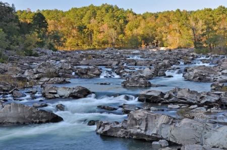
Do you hear that sound? Something is pounding. Do you hear the music? What could it be? You are standing approximately 130 miles southwest of Little Rock, Arkansas, in 5,600 acres of one of the most rugged and spectacular river corridors in the central United States. It is made up of steep wooded slopes, outstanding geological features, and cascading clear water. Not only is the water quality high, but the river features Class III, IV, and even Class V rapids (this is dependent on rain events), making it a favorite with skilled canoeists and kayakers.

Cossatot Falls is one of the most picturesque places in the state.

Cossatot Falls is one of the most picturesque places in the state.

Little-disturbed cedar glades and forests cover many of the steeper slopes. Two species of fish that are found only in the southern Ouachita Mountains–the leopard darter and the Ouachita Mountain shiner–live in the river. Bald eagles winter in the area. Waterfall’s sedge and Ouachita Mountain twistflower, found only in a few counties in the Ouachita Mountains, and a number of other sensitive plant species thrive within Cossatot River State Park-Natural Area’s five natural plant communities.

The hillsides surrounding the river offer unique plants and wildlife to explore.

The hillsides surrounding the river offer unique plants and wildlife to explore.

The combination of natural vegetation, rugged topography, exposed rock formations, and sparkling water creates a scenic extravaganza. You can easily access the river in several places throughout the park, meaning you don’t have to be a skilled kayaker or advanced hiker to enjoy this scenery. Those who want that further challenge certainly have it available to them, but really, this park is open to everyone. Click here for more information on the park’s trails, river access points, floater tips, etc.

The Story of Cossatot:
The idea of establishing a Natural Area along the upper Cossatot River first surfaced in 1974, not long after the Arkansas Environmental Preservation Commission (AEPC) was created. In October, 1975, the staff of Arkansas Natural Heritage Commission (ANHC; formerly the AEPC) contacted Weyerhaeuser Company (WEYCO) to discuss acquiring the Cossatot Falls area and other portions of the Cossatot River corridor. A few months later, in January 1976, the ANHC presented a written proposal to Weyerhaeuser. The Company’s response to that proposal, while positive in many ways, was tempered by concerns over the Commission’s limited manpower resources for overseeing such an intensively-used public recreation area.

Discussions continued off and on until 1984, when productive negotiation began in earnest. By that time, the Division of Arkansas State Parks (ASP) had joined in the effort to protect the river corridor, enabling ANHC and ASP to prepare a joint proposal that addressed the WEYCO’s concerns about the State’s ability to manage the property. Once a tentative sale agreement was reached, the ANHC requested that the Arkansas Field Office of The Nature Conservancy assist with the negotiations and acquisition.

The Nature Conservancy agreed to acquire and hold in trust the acreage identified for the proposed Cossatot River State Park Natural Area (CRSPNA) until funding was available for its purchase.

Negotiations culminated on November 19, 1988, with Governor Bill Clinton’s announcement at a joint meeting of the State Parks, Recreation, and Travel Commission and the Natural Heritage Commission that the State of Arkansas, in cooperation with The Nature Conservancy, would acquire an 11-mile segment of the upper Cossatot River. On December 23, 1987, The Nature Conservancy acquired title to the 4,254-acre park-natural area. Final approval of state park designation was granted by the Legislative Council, per Act 512 of 1975, on February 19, 1988. In May of 1987 the Arkansas Natural and Cultural resources Council approved a multi-year grant for the purchase of CRSPNA. The Council also awarded a first-year stewardship grant for the project.

The Nature Conservancy transferred management responsibility for the area to the State in July, 1988. State Parks and the Natural Heritage Commission entered into a cooperative management agreement.

In 1990 Arkla Gas Company acquired the 160 acre Brushy Creek access tract from private individuals and donated it to CRSPNA in compensation for crossing the park with a 36 inch gas pipeline. With the addition of other land acquisitions, the current size of CRSPNA is 5,600 acres.

Cossatot River State Park’s Mission:
Our mission at Cossatot River State Park-Natural Area (CRSPNA) is, “to provide resource stewardship for the 12 mile CRSPNA river corridor and to sustain the natural integrity of the river and its riparian forest; to enhance public awareness and understanding of our natural resources through environmental education and interpretation. This includes natural resources such as endemic, rare, or threatened plants and animals of the Ouachita Mountains; and natural history of the Ouachita Mountains and the Cossatot River.”

The unique and beautiful geology of the river and its watershed lures many photographers.

The unique and beautiful geology of the river and its watershed lures many photographers.

Cossatot River is one of a kind it is unique in the fact that it is a river that offers Class V rapids (which is dependent on rain events), it is one of the cleanest rivers in the State of Arkansas (the pH average level runs around 6.7), and the river runs north to south, while the surrounding Ouachita Mountains line up east to west.  It is also a state and federal Wild and Scenic Rivers “extraordinary resource” stream.

When weather and water conditions allow, we offer kayaking classes and guided tours down this amazing river.  Here is a blog, written by one of our participants, about camping and paddling on the river with his son.

Enjoy a short movie clip of a part of The Wild and Scenic River:

Of course, when the water wants to get a little rowdy, it can. At these times we recommend only the most experienced kayakers venture out on the river:

Shelley Flanary, Park Interpreter

Shelley Flanary, Park Interpreter

–Shelley Flanary is a park interpreter at Cossatot River State Park – Natural Area. She has worked for Arkansas State Parks since 2001, stsarting out as a seasonal interpreter at DeGray Lake Resort, Lake Catherine, and Petit Jean State Parks. Shelley earned her degree in Parks and Recreation Management from Henderson State University in 2005. She is also an NAI Certified Interpretive Guide, recreational kayak instructor, and emergency first responder.

Pinnacle Mountain State Park Rocks!

January 11, 2010

Pondering Pinnacle Mountain

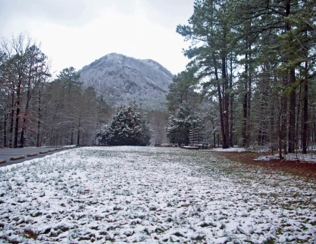
A cold, snowy day can be the perfect time to experience Pinnacle Mountain State Park.

A cold, snowy day is the perfect time to experience Pinnacle Mountain State Park.

This week Pinnacle Mountain has been frozen with solitude.  The warm-weather crowds have diminished to a handful of bundled, determined hikers.  I no longer see colorful climbing dots moving slowly to the top when I look up.  Instead, my eyes tend to focus on the protruding, sharp rock outlays along each side of the uplifted land.

As I gaze at the mountain’s nakedness, it’s easy to recognize why such a dramatic landform is admired by all who know it. What is not so easy to recognize, is how such a landform arose from the earth.

The Making of a Mighty Mountain

Composed of Jackfork sandstone, Pinnacle Mountain rises 756 feet from the base.  Like all the rest of the Ouachita Mountains, it is in the eroded “crumple zone” which resulted from the collision of two continental plates of the earth’s crust.  Before the collision process altered this region, the Ouachitas

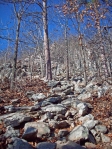
The "boulder fields" on the slopes of Pinnacle Mountain make for interesting hiking.

The "boulder fields" on the slopes of Pinnacle Mountain make for interesting hiking.

were accumulating sediments on the ocean floor several thousand feet below sea level.  After 275 million years of erosion, the Ouachitas–including many peaks like Pinnacle Mountain–are the greatly reduced remains of a once young and mighty mountain range.  The “cone” form of Pinnacle Mountain we see today is simply a small resistant remnant of a highly eroded ridge which runs east and west for several miles.

(Click here to learn more about the six natural divisions of Arkansas.)

Look All Around, But Look Down Too

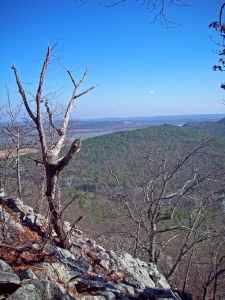
When you hike up the cone-shaped mountain, it is easy to divert your attention away from the wonders of the mountain itself.  It took me several climbs to condition myself not to focus on the sparkling waters of Lake Maumelle or Arkansas River in the

Hiking to the top rewards visitors with awe inspiring views.

Hiking to the top rewards visitors with awe inspiring views.

distance, but instead on the dramatic landform right under my feet. Once I took my eyes and camera off the view, I fell in love with the Jackfork sandstone and became filled with wonder at the creation of the Ouachita Mountains.  It amazed me how simple it was to connect those physical geography facts from high school and college to something that was right beneath me.  Before my discovery, continental plates existed only in text books and on exams, but truly, they are visible, touchable, and climbable!

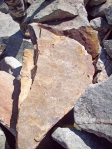
Exploring with your sense of touch is encouraged.

Exploring with your sense of touch is encouraged.

This Stone is Full of Stories

One of my favorite parts of climbing the mountain is the feeling of the sandstone beneath my hands.   It has a rough grainy texture that embodies its name well.  There are countless sandstone boulder fields on the mountain and scattered around this 2000-acre park, which makes them easy to take for granted. However, without this stone, many important places around Little Rock would not exist as we know them today.  Over 75,000 tons of rock was taken from the base of the east side of Pinnacle Mountain to create the Lake Maumelle Dam for Little Rock’s water supply.  Also, rock was moved from other areas of the park prior to the 1950s to help build the local Joe T. Robinson Schools and Shrine Country Club.

Two Routes to the Top

The trails to the top can be challenging and enjoyable.

The trails to the top can be challenging and enjoyable.

There are a number of trails at Pinnacle Mountain State Park, all designed to showcase various aspects of this diverse landscape. Collectively, we hope they help you understand that everywhere you walk here, from wetlands to upland ridges, you see an ever-changing web of life that flourishes because diverse habitats are protected.

In case you haven’t been to the top of Pinnacle Mountain, you should know that there are two main routes for getting there. The most popular path is via the West Summit Trail. This rocky trail begins at the park picnic grounds and winds its way up to the top for ¾ of a mile. To return, you must retrace your steps, for a 1 ½ mile round trip journey, or hike down the other side of the mountain using the rugged East Summit Trail and return on the Base Trail for a total hike of about 3 miles.

If you prefer more of a challenge, plan to go up and down the mountain using the more rugged, ¾-mile East Summit Trail. This route is often referred to as more of a “climb” than a hike, as it crosses several boulder fields and takes a more direct (steeper) route to the top than the meandering West Summit Trail. Technical rock climbing is not required, but much of the hike does require hands-and-feet scrambling as opposed to upright walking.

Either way, this hike is considered strenuous and you should allow at least 1 ½ hours travel time—plus give yourself extra time along the way and at the top for reflection and exploring.

Learning from the Land

Pinnacle Mountain is a dramatic landform that has inspired me to learn more about my local surroundings.  It is also a place where I have been able to provide curious students with real world examples from their textbook lessons and state-mandated curriculum.

No matter your reasoning for visiting Pinnacle Mountain State Park, I am sure that the scenic view—and the mountain itself—will ignite your passion for understanding your environment. I hope you are one of the next bundled-up, determined, wonder-filled hikers that I meet at the top!

The park maintains over 40 miles trails with something for everyone.

The park maintains over 40 miles trails with something for everyone.

Kristina Root, Park Interpreter

Kristina Root, Park Interpreter

Kristina Root is a strong advocate of environmental education for urban children. She has worked for Arkansas State Parks since 2007, stationed at Pinnacle Mountain State Park as a park interpreter. She is a Certified Interpretive Guide, and credits success on her career path to her B.S in Environmental Science from the University of Central Arkansas.